Yorke Peninsula & Copper Coast Map
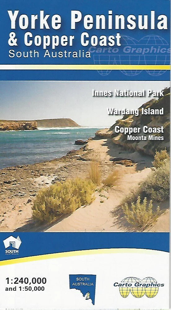
This map from Carto Graphics features a 1:240,000 scale map of the Yorke Peninsula in South Australia. Road distances are noted and towns and localities, parks and reserves are listed with grid references. Marked on the map are wrecks and lighthouses, wind turbines, visitor information centres, cellar doors, lookouts and camping grounds, boat ramps and beach launches, and surf breaks. National parks, conservation parks and reserves, and forest reserves are also shown along with 4WD tracks.
Printed in 2020, the Yorke Peninsula and Copper Coast Map is well suited to those seeking detailed information on Innes National Park, Wardang Island, and the Copper Coast – Moonta Mines.
Walking trails and 4WD tracks are clearly marked on these maps along with all listings on the main map as well as the Martime Heritage Trail Interpretive Sign, information centres, ranger stations, self-registration stations, caravan parks and sites, camping grounds, phones, toilets, and hiking trails.
Key Features
- Detailed 4WD tracks
- Walking tracks
- National parks
- Camping areas
- Points of Interest
Key Specifications
Edition: 2nd
Publication Date: 01/01/20
Scale: 1:240,000
Folded size (WxHxD): 140mm x 250mm x 3mm
Weight: 0.08kgs
Product Information
Product Information
Shipping & Returns
Shipping & Returns
Description
This map from Carto Graphics features a 1:240,000 scale map of the Yorke Peninsula in South Australia. Road distances are noted and towns and localities, parks and reserves are listed with grid references. Marked on the map are wrecks and lighthouses, wind turbines, visitor information centres, cellar doors, lookouts and camping grounds, boat ramps and beach launches, and surf breaks. National parks, conservation parks and reserves, and forest reserves are also shown along with 4WD tracks.
Printed in 2020, the Yorke Peninsula and Copper Coast Map is well suited to those seeking detailed information on Innes National Park, Wardang Island, and the Copper Coast – Moonta Mines.
Walking trails and 4WD tracks are clearly marked on these maps along with all listings on the main map as well as the Martime Heritage Trail Interpretive Sign, information centres, ranger stations, self-registration stations, caravan parks and sites, camping grounds, phones, toilets, and hiking trails.
Key Features
- Detailed 4WD tracks
- Walking tracks
- National parks
- Camping areas
- Points of Interest
Key Specifications
Edition: 2nd
Publication Date: 01/01/20
Scale: 1:240,000
Folded size (WxHxD): 140mm x 250mm x 3mm
Weight: 0.08kgs